University of California Press

Iron Muse

Photographing the Transcontinental Railroad

by Glenn Willumson (Author)
Price: $39.95 / £34.00
Publication Date: Nov 2023
Edition: 1st Edition
Title Details:
Rights: World
Pages: 254
ISBN: 9780520955424
Endowments:

Read an Excerpt

1

Preparing the Ground

"Bound for the Mountains"-this affirmation summarized the aspirations of the Union Pacific and Central Pacific Railroads. The Union Pacific route called for track across hundreds of miles of Nebraska prairie before it reached the challenging Rocky and Uinta Mountains in Wyoming and Utah. The Central Pacific had only a few dozen miles of flat land before it began to lay track in the foothills and then the rugged slopes of the Sierra Nevada. Despite such difficulties and the ongoing Civil War, officials from both the Union Pacific and the Central Pacific broke ground in 1863 and began construction of the nation's first transcontinental railroad. The phrase "Bound for the Mountains" expressed an implicit expectation and also served as the title of an extraordinary photograph made shortly after construction began: Bound for the Mountains, 12 mile tangent-4 miles from Sacramento summarized, visually and verbally, the railroads' hopes, aspirations, and determination.

The locomotive, sunlight gleaming on its polished surface, seems to rush away from the viewer and down an apparently infinite line of straight track called a tangent. Aligning the metal smokestack of the locomotive precisely along the left edge of the rail creates a vector that projects into deep space. This compositional precision, and the smoke that pours from the stack, combine to give the impression of the railroad's force and speed. In fact, the locomotive was stationary. Nineteenth-century photographic emulsion was not sensitive enough to stop the movement of a train, but by climbing to the top of the locomotive and making the boiler project from the foreground of the image, the photographer deceives the viewer into thinking that the train is in motion. This effect produces a visual manifestation of ambition and optimism, but it is the contrived and manipulative aspects of the photographic presentation that are the most indicative of the years leading up to the groundbreaking for North America's first transcontinental railroad and the decades that followed its completion. Just five years earlier, the project had seemed impossible.

In 1858, Jefferson Davis, senator from Mississippi, addressed the question of the transcontinental railroad on the floor of the Senate: "In Congress, with all due respect to my associates, I must say the location of this road will be a political question. It should be a question of engineering, a commercial question, a governmental question-not a question of partisan advantage or of sectional success in a struggle between parties and sections." Davis was lamenting Congress's inability to ratify a report he had authored three years earlier as secretary of war. In 1853, Davis assigned army exploration parties to establish the best passage for a transcontinental railroad. The resulting reports began the process of establishing the route, raising significant questions about geography-for example, the best way to get through the Rocky Mountains and the Sierra Nevada. But the politics of expansion and regional rivalries prevented congressional agreement. Ultimately, it was the Civil War that settled the question of the route to California, and it was the development of a set of photographic practices outside the studio and the visual articulation of that national struggle that foreshadowed the way the railroad corporations would use photographs during the construction of the transcontinental railroad.

Early reports about the country through which the railroad would be built were not promising. In 1819, Major Stephen Long and his exploration party followed the Platte River from the Missouri River to the Rocky Mountains, the same area the Union Pacific would later use to construct the eastern leg of the transcontinental railroad. Although he did not search for a pass through the mountains, Long did describe the territory: "We do not hesitate in giving the opinion, that it is almost wholly unfit for cultivation, and of course uninhabitable by a people depending upon agriculture for their subsistence." His map, a primary source for explorers and emigrants for the next twenty years, labeled the area as the "Great American Desert." Two decades later, John Fremont led an expedition over the Rocky Mountains, into the Great Basin of the Salt Lake Valley, and through the Sierra Nevada to the Pacific Coast. One of his goals was to follow the Oregon Trail and search for passes through the Rocky Mountains. The land to the east of Fort Laramie in the Black Hills, the area through which the Union Pacific eventually would drive its tracks, Fremont described as arid and dry, a country of stunted pines and dry creeks that gave him a feeling of desolation. This characterization remained in the popular imagination until the 1860s, and Union Pacific promotional efforts battled this idea of the land as inhospitable.

After resting in Oregon, Fremont marched south following the eastern side of the Sierra. Coming upon the Truckee River in an area that later would be graded by the Central Pacific Railroad, Fremont turned west to cross the mountains. It was a disastrous decision that resulted in the near starvation of the party, which Fremont dramatically recounted: "The mountains all are higher [than those in the East], more numerous, and more distinctly defined in their ranges and directions.... [The Sierra Nevada and the Coast Range present] higher elevations and peaks than any which are to be found in the Rocky mountains themselves. In our eight months' circuit, we were never out of sight of snow; and the Sierra Nevada, where we crossed it, was near 2,000 feet higher than the South Pass in the Rocky mountains." The lithographic illustration titled Pass in the Sierra Nevada shows a tattered band of explorers trudging through deep snow. They are dwarfed by large trees and face seemingly impenetrable mountain ranges. One of the lasting impacts of Fremont's exploration was the publication of a large map that produced the most comprehensive picture of the Sierra Nevada, showing it as a more formidable barrier than had been indicated on earlier maps.

If the geographic imagination of the West was created by the army explorations and cartographic representations, popular imagination, especially of the Sierra Nevada, was inflamed by the story of the Donner Party. This group of emigrants had traveled west by wagon train in 1846. Because of a series of delays, they found themselves crossing the Sierra Nevada near Fremont's pass in November 1846, when an early snowstorm stopped the travelers east of Donner Lake. Soon they exhausted their food supplies and faced slow starvation. To stave off their hunger they ate the frozen carcasses of the starved oxen that had pulled their wagons, boiled the bones of horses to make soup, and some, according to contemporary reports, resorted to cannibalism. When they were finally rescued in February 1847, only forty-eight of the original eighty-seven members of the party were alive. The sensational story of starvation, death, and cannibalism resonated with the public imagination and demonstrated viscerally the impenetrability and destructive power of the Sierra Nevada. This impression of the Sierra Nevada had to be overcome if the Central Pacific Railroad was to successfully lure investors.

The most immediate antecedent for the railroad, however, was a series four simultaneous explorations begun in 1853, sponsored by the federal government, expressly for the purpose of locating the best route for the first transcontinental railroad. When it first commissioned the surveys, Congress hoped that they would end the partisan arguments surrounding railroad development; instead, the published reports only intensified animosities. By the 1850s, questions of sectionalism and slavery had become integral to the debate over the railroad. When Asa Whitney proposed a transcontinental railroad in 1844, a host of cities vied for the right to be "the gateway to the West." Choosing which city would be the eastern terminus, however, was only part of the political problem: the latitude the railroad's route would trace was far more decisive. Northern politicians wanted a northern or a central route, hoping to funnel raw materials and trade to the factories in the northeast. Southern leaders promoted a southern route with the expectation that it would guarantee their region's economic independence and open up new territory to slavery. And both regions envisioned their cities and ports as vital links between Asia and Europe. Not surprisingly, the politics of expansion and the tension between the North and South played a decisive role in the debate over the location of the transcontinental railroad.

Stephen Douglas, a senator from Illinois, offered the most consistent congressional support for a transcontinental railroad. Douglas favored a central route for political and personal reasons. As a recognized champion of the interests of the Northwest and chairman of the Senate Committee on Territories, Douglas presided over the organization of territorial governments and understood that there would be political advantage in opening up new lands for settlement. He hoped that as farmers replaced the Plains Indians, they would become new Democratic voters and would open new markets in need of a railroad. In 1852, however, the landscape west of the Missouri River and north of Texas had been set aside for Indians and was, therefore, off-limits to European American settlement. As a first step, therefore, Douglas fought to create a new territory, hoping to negate the title the Indians held to the land and to open it for white settlement and government railroad subsidies. Douglas appeared to have the opening he needed when the House passed a bill calling for the organization of the Nebraska territory in early 1853. When Douglas brought the bill before the Senate, however, southern senators refused to support it and threatened a filibuster. They had good reason to fear Douglas's proposal. Because the new territory of Nebraska was north of latitude 36 degrees 30 minutes, the Missouri Compromise of 1820 closed it to slavery; consequently, its eventual incorporation as a state would increase the power of the North in Congress. Faced with an impasse, the Senate tabled the bill indefinitely, effectively killing Douglas's railroad proposal.

In the face of southern opposition, in 1853, Senator Richard Broadhead of Pennsylvania offered a compromise amendment to the army appropriation bill that provided for government-funded surveys of all the potential railroad routes. The federal government had been underwriting army exploration of the West since 1804, institutionalizing the exploratory impulse in 1838 with the formation of the Army Corps of Topographical Engineers. Earlier explorations surveyed wagon roads through the western territory, but the expeditions funded by the army appropriations bill of 1853 would be the first to look for a railroad route. Senators from both northern and southern states supported Broadhead's amendment. They hoped that the explorations would provide objective data and move the question of a transcontinental railroad beyond the divisiveness of sectional politics.

Despite the seeming equanimity of this solution, the appointment of Jefferson Davis as secretary of war in 1853 polarized the question once again. Davis, a staunch supporter of the southern cause and future president of the Confederate States of America, selected the routes to be surveyed, named the members of the exploratory parties, and published their findings. For many northern politicians his involvement prejudiced the surveys from the beginning, but some historians have argued that Davis acted equitably. They point to his nomination of northern men to head most of the surveys and to the "geographical realities" that guided his decision about which routes to explore. However, Davis's letters, the sequence of the reports' publication, and the contradictions between images and text provide evidence of the subtle ways the information he presented favored a southern route for the railroad.

Senators favoring a central or northern route had good reason to suspect Davis. Two years earlier he had written to President Millard Fillmore about the boundary between the United States and Mexico:

Past reconnoissances [sic] have taught us that a practicable route for waggons [sic], or Rail-road might be found from the Paso del Norte to the Gila River and thence to the Colorado, and great hope and expectation have thus been excited.... I suppose then it may be said that the great object to be gained in the location of this boundary line was to secure on the side of the United States a practicable route for a military road, ultimately perhaps the construction of a rail road connecting the Mississippi valley with Southern California.

Davis suggested the appointment of Major William Emory to head the reconnaissance of the southern border. Emory had strong southern political connections and was an acknowledged advocate of a southern route for the railroad. Davis wanted Emory's report to demonstrate the necessity of further land concessions that would allow a railroad to bypass the steep inclines of the Gila River region. Davis got his way. Fillmore named Emory the leader of the boundary commission, and three years later, the Gadsden Treaty added the territory Davis needed for a southern railroad route.

In 1853, as the new secretary of war, Davis appointed three exploration parties to search for a route from the Mississippi River to the West Coast. They ignored the southernmost route, and none of them explored the land on which the transcontinental railroad would eventually be built. Issac Stevens, an engineer on an earlier Pacific Coast survey and the governor of the Washington Territory, led the northernmost exploration along the 47th and 49th parallels. Lieutenant John W. Gunnison, assistant to Howard Stansbury during his survey of the Great Salt Lake in 1849-50, explored the central landscape, on the 38th and 39th parallels. Lieutenant Amiel Whipple, assistant astronomer on Emory's Mexican boundary survey three years earlier, led an exploration along the 35th parallel. With the three reconnaissance parties in the field, Davis secured additional appropriations and, in late 1853, sent Lieutenant John Parke and Captain John Pope to extend Emory's earlier explorations and to do further mapping along the 32nd parallel. In addition to these east-west explorations, Davis assigned Lieutenant John Williamson to search for passes through the southern Sierra Nevada and to survey the West Coast from Los Angeles to the Columbia River. These "surveys," however, did not chart the landscape but provided a sense of the topography along certain latitudinal parallels. As such, these were "reconnaissance" trips more than surveys.

While the exploration teams were still in the field, Stephen Douglas maneuvered a new bill through the Senate. Stifled by the bitter sectional debate between North and South, in January 1854 Douglas offered a plan to gain southern legislative support. He agreed to introduce legislation to repeal the Missouri Compromise of 1820 in exchange for southern support for the new territory of Nebraska. His proposed law negated the earlier legislation that had barred slavery north of latitude 36° 30′, and it allowed each newly admitted state to decide whether it would be free or slave. Despite resistance from the majority of northern senators opposed any increase in slave-holding states, Douglas persuaded enough northern Democrats to repeal the Compromise of 1820 and was rewarded with southern support for the new territory of Nebraska. The opening of the center of the country to settlement, Douglas felt, presaged the ultimate success of a central railroad route.

Southerners, including Jefferson Davis, saw the possibility of a double victory: opening up new territory to slavery through the repeal of the Missouri Compromise and securing a southern route for the first transcontinental railroad by making effective use of the Pacific railroad surveys. Davis wrote to the Mississippi Democrat William Cannon, outlining his calculation about the transcontinental railroad:

The country on the Pacific is in many respects adapted to slave labor, and many of the citizens desire its introduction.... [This] has led me to ask why the advocates of domestic slavery should not have acquired the control of California and Oregon. The answer has seemed to me to be this: The only convenient route for emigrants is now by sea and across the Isthmus, and the vessels for this line of communication start from Northern ports, thus shutting out those who must take with them their servants, their flocks and herds and [thus] securing a Northern Immigration to that country which would first unite our population. If we had a good railroad and other roads making it convenient to go through Texas into New Mexico, and through New Mexico into Southern California, our people with their servants, their horses and their cows would gradually pass westward over fertile lands into mining districts, and in the latter, especially, the advantage of their associated labor would impress itself upon others about them and the prejudice which now shuts us out of that country would yield to the persuasion of personal interest.

Davis understood the question of the railroad route to be central to the political questions of slavery and political power.

With slavery now possible in the new territories, Davis turned his attention to the Pacific railroad explorations. The reports from the army expeditions were published in twelve volumes over a five-year period, with the first eight printed under the watchful eye of Jefferson Davis. The first five volumes, published in 1855 and 1856, establish the antebellum context for the transcontinental railroad. Volume 1 serves as both introduction and conclusion as it begins with Davis's recommendations followed by brief descriptions of the explorations of the 47th and 49th parallels, the 41st and 42nd parallels, the 38th and 39th parallels, the 35th parallel, and the 32nd parallel. Not surprisingly, Davis argues for a southern route:

A comparison of the results stated above, and those exhibited in the tables referred to, conclusively shows that the route of the 32nd parallel is, of those surveyed, "the most practicable and economical route for a railroad from the Mississippi river to the Pacific ocean."

This is the shortest route; and not only is its estimated cost less by a third than that of any other of the lines, but the character of the work required is such that it could be executed in a vastly shorter period.

Davis claimed that he based his judgment on the review of each of the proposals, and he used the publication of the Pacific Railroad Reports to support his conclusion.

The publication of volume 2, in 1855, was meant to defuse the challenge of Davis's most strident political opponent, Thomas Hart Benton of Missouri. Senator Benton's powerful position in the Senate and his strong support of a central route for the railroad made the survey of the 38th and 39th parallels a political necessity. The published volume included detailed reports of Davis's favored southern route-the 32nd parallel-and Benton's preferred route. Lieutenant E.G. Beckwith, the ranking officer of the survey party of the central route, supported the latter as a viable route for the railroad. He wrote about the obstacle of the Rocky Mountains: "A railroad ... would cross the summit-level near the base of these peaks, and, taking advantage of the winding slopes, pass down the right of the creek to Turret rock, to where the park becomes a gorge, and thence be confined to the little valley, from one hundred and fifty to three hundred feet in width, where it could be constructed along the foot of the hills with great ease." Although Beckwith's written report supported the route Benton favored, the lithographic illustrations included in Volume II did not bolster Beckwith's argument.

Beckwith's report was the first to contain illustrations. Significantly, these eleven lithographs represented just two areas covered by the 38th parallel survey-the passes through the Rocky Mountains and the landscape around the Green River. Formally, the lithographs use pictorial codes that attempt to strengthen their connection to the reality of the landscape. The color shifts from more vibrant foregrounds to muted backgrounds, a technique designed to suggest atmospheric perspective. This effect is furthered by detailed foregrounds that give way gradually to vaguely defined background spaces. In Sangre De Cristo Pass, From near the Summit, looking down Gunnison's Creek, there are a few trees, and the hillsides are barren of the timber that would be needed to build a railroad. Furthermore, the stacking of the peaks, and the deep river gorge leading to the background, creates gaps in the receding mountains that suggest a rugged, noncontinuous landscape. There is nothing in this lithograph to suggest that a railroad could be built here "with great ease."

The lithographs showed the topography of the West to congressmen who would never see the actual landscape, but who would nonetheless decide whether it was suitable for a railroad. Rather than illustrating the written report, the prints served instrumentally as a parallel text, visually representing rugged mountains and an inhospitable land. Few of the 38th-parallel lithographs show a landscape suitable for a railroad. The foreground detail of Rock Hills between Green and White Rivers, for example, included cactus and yucca plants, both associated with desert country and a lack of water and timber. This botanical rendering as well as the descriptive title "Rock Hills" would have discouraged any proposal to place a railroad in such a wilderness. In contrast, Beckwith's written report presents a very different description of the area: "In a few instances the strata of red, yellow, gray, and white sandstone were observed bent; but they were generally in right lines, with a dip to the east-northeast. We passed occasional masses of conglomerate rocks, and on the hills scattering cedar trees and some fine fields of bunch-grass."

The lithographs of the 38th and 39th parallels showed a landscape not conducive to railroad construction, whereas the report about the southern 32nd parallel route included no illustrations, allowing the description of a flat, readily accessible landscape to stand on its own and suppressing information about the harshness of the deserts of southern New Mexico and Arizona. More than a decade before the Central Pacific Railroad commissioned photographs to support its construction project, the Pacific Railroad Reports demonstrate the ways in which images could be used to buttress particular political positions.

Volumes 3 to 5, published in 1856, bolstered Davis's recommendation of the route along the 32nd parallel. Volumes 3 and 4 outlined the topography, geology, and zoology along the 35th parallel. These volumes, among the most visually lively of the reports, included both full-page lithographs and wood engravings set within the text. The lithographs display large flat expanses of land, but also display high mountain ranges, providing visual evidence for Davis's assertion that the route was unfavorable because of "the large sum of ascents and descents." In addition to recording geography, the 35th parallel reports chronicle the cultural landscape, offering a glimpse of racial politics that formed a subtext of the Pacific Railroad Reports. Several of the illustrations depict the indigenous peoples as peaceful and domesticated and dressed in European-style clothing. Although the text could have described such dress, illustrations carried greater force. These images of peaceful tribes with their familiar habits stand in direct contrast with the nomadic and warlike tribes of the Plains, where a central railroad route would be built. Volume 5 suggested possible routes through the southern Sierra to the Pacific Ocean. Specifically, Davis charged Captain Williamson with finding routes through the southern Sierra Nevada along the 35th and 32nd parallels. He reported favorably on the several mountain passes, all of which could connect with the 32nd parallel route. In this case, the majority of the lithographs and wood engravings that illustrated his report showed wide spaces and rolling hills that could easily accommodate a railroad.

Public interest in the transcontinental railroad extended beyond the political sphere. In 1853, the same year that Jefferson Davis sent army surveyors west, Asher B. Durand's Progress (The Advance of Civilization) was displayed at the annual exhibition of the National Academy of Design. Durand's patron for the painting, Charles Gould, was an official of the Ohio Mississippi Railroad, and although Gould's railroad interests were regional, certain of the painting's compositional details and its implicit narrative of European-American advancement link it to the national debate about a transcontinental railroad. Progress summarized the aspirations of Americans who saw in the construction of the railroad the possibility for national unity and cultural identity. The painting's narrative begins in the lower left, in an undeveloped wilderness from which Indians look down on a landscape transformed by European-American settlers. The technologies associated with roads, canals, and railroads transform the landscape. The composition leads the eye into the deep space of the painting, where a busy port city, shimmering like gold, is the culmination of the progress described by the work's title and the destination of empire. An extensive wilderness, like that in the center of the antebellum United States, separates settlements in the foreground from the distant city of light.

Plumes of smoke from a tiny train, barely visible as it moves across a bridge in the middle ground, can be seen on the right side of the canvas, where the billowing cloud of ash suggests the train's speed as it moves toward the wilderness in the center of the painting. The artist reconciles technology and nature in an oddly disquieting scene in which the train seems to come from nowhere and has no pathway for continuing its journey. Nonetheless, the force of the composition connects the train with the idealized city in the distance by means of an imagined route that leads from the cultivated foreground into a nondescript wilderness and, finally, to the shimmering port city. Durand's Progress naturalizes the expansionist rhetoric that governed the congressional debates, linking the Jeffersonian farmers in the foreground with the industrialized city dwellers in the distance, a connection visually carried, in part, by train technology. The inevitability of European-American progress implied by the Indians, who have been pushed to the margins of the painting, was echoed in the halls of Congress. Stephen Douglas's argument for the Nebraska territory proposed native displacement in order to open the landscape of the plains to European-American settlement. What remained unresolved in Congress, and in the painting, was the exact route the locomotive would take to the vision of prosperity in the distance.

All of this attention to possible railroad routes did little to reconcile the arguments about the location of the transcontinental railroad. If Congress hoped that the Pacific railroad surveys would take politics out of the decision about where to build the railroad, its members were misguided. Jefferson Davis understood the value of the transcontinental railroad in social, political, and economic terms. Even after he left his post as secretary of war, he continued, as the senator from Mississippi, to advocate the 32nd parallel route. James Buchanan made his support of the construction of a transcontinental railroad a plank in his presidential campaign, and calls for the railroad were renewed when he was elected president in 1856. Buchanan agreed to provide federal support for the construction, and a Senate select committee reported a bill to the full Senate in the 1857-58 session and again the following year. Each time it was proposed, sectional differences doomed the appropriation. Southerners opposed it because they believed it favored a northern route and left the South without a railroad. Northerners were unwilling to support any bill that might make a southern route the single railroad to the West. These congressional divisions, evident from the first mention of a transcontinental railroad, were not resolved until after the secession of the southern states and the advent of the Civil War.

The conflict brought together several factors that would serve the railroad companies and may have influenced their attention to imagery. Before the war, train travel in the United States was disorganized and disconnected. With the advent of the conflict and the need to transport massive amounts of troops and supplies, Tom Scott, vice president of the Pennsylvania Railroad, created a centralized system of railroads in the North. The standardization of the track, and the federal government's need for financial capital, brought about the creation of financial institutions that would become models for financing the railroad after the war. Concomitantly, photography also streamlined and standardized certain aspects of its practice. Seeking to document the war visually, Mathew Brady organized teams of photographers and sent them into the field. The photographs these men produced demonstrated the power that imagery could exert on a general audience. Although Brady sold the photographs his men produced, often without crediting the photographer, some of these images found outlets as wood engravings in illustrated newspapers. This relatively new genre of news production flourished during the war by bringing news to a public that understood itself increasingly in terms of nation rather than region.

Politically, the loss of Southern Democrats in Congress meant that sectional gridlock ended. The second session of the Thirty-Seventh Congress passed legislation that put the federal government at the forefront of socioeconomic development and laid the blueprint for modern America. The Republican majority passed landmark legislation, including the Homestead, Morill, and Pacific Railroad Acts. These circumstances settled the location of the transcontinental railroad along a central route; new organizational models of photographic practice laid the groundwork for the photographic documentation of the transcontinental railroad. Specialized firms had mass-produced photographs for more than a decade, but most of those images had been made in the studio. Photographic equipment was difficult to transport; the wet-collodion process was cumbersome; and, because of the long exposure time, plates were incapable of capturing action. Nonetheless, entrepreneurs like Mathew Brady believed that the public would want photographic images of the war, and he applied the techniques of large-scale industrial production to photography. Shifting his attention from a regional to a national audience and reorganizing his studio-based practice to support teams in the field, Brady established a new practice of outdoor photography. He replaced individual labor with organized, communal effort, creating supply stations for teams of photographers in the field and collecting their negatives in his studios in New York and Washington, D.C. In this dehumanized framework, Matthew Brady's name as the supervisor appeared on his team's photographic documentation of the Civil War, although he made none of those photographs.

The public perception of the camera's veracity allowed photographers to re-create the war as a visual spectacle, which often included dead bodies in the aftermath of a battle. Brady's corps of photographers gave people on the home front the immediacy, vividness, and authenticity that appealed to them. Reviewing the Brady photographs of Grant's Virginia campaign in 1864, Harper's Weekly commented, "The actuality of these views, the distinct detail, and the inflexible veracity, make them invaluable to every student of the campaign; while all who follow the army with their private hearts as well as their public hopes will see with curious satisfaction the roads, the fields, the woods, the fences, the bridges, the camps, and the streams, which are the familiar daily objects to the eyes of their loved soldier boys." The public craved the affective experience of imagery, but the veracity of photography could be disturbing. A New York Times story about the exhibition of Brady's images of Antietam photographs conveyed their impact on the contemporary audience:

Mr. BRADY has done something to bring home to us the terrible reality and earnestness of war.... Of all objects of horror one would think the battle-field should stand preeminent, that it should bear away the palm of repulsiveness. But, on the contrary, there is a terrible fascination about it that draws one near these pictures, and makes him loath to leave them. You will see hushed, reverend groups standing around these weird copies of carnage, bending down to look in the pale faces of the dead, chained by the strange spell that dwells in dead men's eyes.

The experience of viewing Brady's Civil War photographs was made all the more shocking by the fact that most of them were stereographs. Stereographs use a twin-lens camera to create negatives spaced two and a half inches apart, replicating the distance between a human's eyes. These paired images are printed and mounted side by side on thick pasteboard. To create the stereographic effect, one looks into a special device that blocks out all peripheral vision and causes the two images to merge optically into a single photograph with dramatic three-dimensional depth. The visual space of the image seen in the stereoscopic viewer is layered with information in the foreground, middle ground, and background. Exploring the stereograph, the eye moves from plane to plane, object to object, savoring the three-dimensional illusionary space.

The hyperreality of this form of photography could delight the beholder, as Oliver Wendell Holmes described in 1859: "The first effect of looking at a good photograph through the stereoscope is a surprise such as no painting ever produced. The mind feels its way into the very depths of the picture. The scraggy branches of a tree in the foreground run out at us as if they would scratch our eyes out.... Then there is such a frightful amount of detail, that we have the same sense of infinite complexity which Nature gives us." When it came to viewing stereographs of the war, however, this delight quickly turned to distress. Holmes, for one, found the stereograph's emotional reality too painful to look at: "It was so nearly like visiting the battlefield to look over these views, that all the emotions excited by the actual sight of the stained and sordid scene, strewed with rags and wrecks, came back to us, and we buried them in the recesses of our cabinet as we would have buried the mutilated remains of the dead they too vividly represented." Three years later the Central Pacific Railroad would depend on stereography's ability to create visceral images to record its spectacle of technology.

The United State military also documented the war in photographs but sparingly and primarily for utilitarian purposes. Early in the war General Herman Haupt, a brilliant railroad engineer and tactician, employed the photographer Andrew J. Russell to make photographs for an instruction manual, Photographs Illustrative of Operations in Construction and Transportation. The book would be distributed to army officers and, to ensure continued support for Haupt's efforts, to members of Congress as well. The manual's eighty-two photographs illustrate "experiments made to determine the most practical and expeditious modes to be resorted to in the construction, destruction, and reconstruction of roads and bridges." Russell, later the photographer of the Union Pacific Railroad, was the only official military photographer of the Civil War. His photographs for Haupt showed the calculation, discipline, and efficiency of the military workforce. Russell's photographs show the calculation, measurement, and mechanization necessary for a modern railroad. Here, also, one finds the dehumanization of the men pictured. These lessons about organizing a workforce and mechanizing their production would soon be applied to the construction of the transcontinental railroad.

In addition to the widespread practice of outdoor photography, the war also coincided with the rising social importance of illustrated newspapers. In 1860, New York supported three such papers: Harper's Weekly, Frank Leslie's Illustrated Newspaper, and New York Illustrated News. Although these publications struggled before the war, public interest in news and a thirst for pictorial illustration meant all three newspapers flourished after 1861. In addition to the weekly publication of large numbers of images-a Leslie's Illustrated editor boasted of his paper's publication of nearly three thousand pictures of the war by 1864-both Leslie's Illustrated and Harper's Weekly produced commemorative books of wood engravings that had previously been published in the newspapers. Sketch artists provided most of the war illustrations for the paper's editors, who rushed them to the engraver for transfer to a wood block and publication alongside the textual descriptions. This public hunger for information and the resulting increase in the circulation would later be exploited by the Union Pacific and Central Pacific Railroad companies.

The rise in the sales of illustrated newspapers also indicated a shift of American interests from region to nation. As the ferocity of the war increased, Americans turned from the local and regional issues that had dominated antebellum public discussions to more national concerns. Oliver Wendell Holmes personifies the railroad as the metaphor for this new nationalism:

War is a new thing to all of us who are not in the last quarter of their century. We are learning many strange matters from our fresh experience. And besides, there are new conditions of existence which make war as it is with us very different from war as it has been.

The first and obvious difference consists in the fact that the whole nation is now penetrated by the ramifications of a network of iron nerves which flash sensation and volition backward and forward to and from towns and provinces as if they were organs and limbs of a single living body. The second is the vast system of iron muscles which, as it were, move the limbs of the mighty organism one upon the other.

The movement for a transcontinental railroad benefited from this more nationalistic focus. In place of the regional North-South agenda that had dominated American politics, a new East-West orientation was born out of America's emergent national interest.

In the face of the disheartening war news found in Brady's photographs and on the pages of northern newspapers, the opening of the American West offered the possibility of renewal in a new, innocent landscape. When Nathaniel Hawthorne visited Washington in early 1862, he delivered a pessimistic report on the health of the nation: "A railway-train met us, conveying a regiment out of Washington to some unknown point; and reaching the capital, we filed out of the station between lines of soldiers, with shouldered muskets, putting us in mind of similar spectacles at the gates of European cities. It was not without sorrow that we saw the free circulation of the nation's life-blood (at the very heart, moreover) clogged with such strictures as these." The only hopeful sign that Hawthorne reported was a mural by Emanuel Leutze: "It looked full of energy, hope, progress, irrepressible movement onward[,] ... and it was most cheering to feel its good augury at this dismal time, when our country might seem to have arrived at such a deadly stand-still." The subject of Leutze's mural was the American West, and it decorated a stairway in the United States Capitol building. The twenty-by-thirty-foot painting Westward the Course of Empire Takes Its Way [Westward Ho!] celebrated westward migration and allowed the eastern men like Hawthorne to turn away from the despair and gloom of the war and remember the optimism of American exceptionalism and promise.

Leutze's ability to spark a sense of hope lay in his formal means of representation and in his chosen subject matter of the North American West. As he struggled to finish the mural, the human cost of the war confronted Leutze daily when military necessity dictated that the Capitol building be used as a makeshift hospital for wounded soldiers. One can see several references to the effect of the war in his composition and iconography. Contemporaries noted the location of the emigrants on the Continental Divide and the contrast between the color tonality on the left and right sides of the painting: "At the right is a snowy peak, the gold of the sunlit snow barred by cool blue shadows. All behind them is gloom where the mists are gathering, and all before them a sunny dream." The location atop the Rocky Mountains placed the party in the center of the continent. Behind them lay the ravages of the Civil War, and in front of them the West beckoned with dreams of a prosperous future. In contrast to the commercial development of Durand's golden city, in Leutze's painting the distant landscape is latent and innocent, awaiting the spread of progress.

The public unveiling of Westward the Course of Empire in December 1862 brought multiple reviews-all of them similar in tone and content. The newspaper the Boston Transcript invoked Bishop Berkeley, the author of the phrase that served as the title of the mural, and singled out the two men carrying the American flag to the top of the rock: "Two of the party are emulous to plant the Stars and Stripes upon the topmost peak, and, in these dark days of trial, we felt the beauty of the whole marvelous production almost as a prophetic conviction that the idea of our "manifest destiny" could not perish. The eye follows the finger of the foremost figure, over miles and miles of mountain tops. 'Alp upon Alp,' marked by the signal fires of the Indians, into the dim and distant future." Leutze's mural offered hope that Americans would recover from the war, and that a new sense of national purpose could be found by looking to the West. The transcontinental railroad provided access to this bright promise. But exactly what type of access was open to question. If Leutze's painting is considered in relationship to Russell's photographs for General Haupt, it becomes clear how outmoded the scene in the mural was. Leutze depicts dramatic, individual actions and a triumphal march over the Continental Divide. Russell's photographs present a new social model-a communal effort by a disciplined labor force mechanistically working together to accomplish a goal in which they had no personal investment.

The Civil War brought the question of a railroad to the Pacific to renewed public attention. Images of the railroad were imprinted on patriotic envelopes and painted in the dome of the United States Capitol Building. Prodded by concerns about the loyalty of the states along the West Coast, a desire to unite the country, and the lobbying of corporations hoping to benefit from the construction of the railroad, the House and Senate passed the Pacific Railroad Act of 1862. The act chartered the Central Pacific Railroad to build east from Sacramento, California, and the Union Pacific Railroad to build west from Omaha, Nebraska; they would meet at a point to be determined at a later date by each company's progress. The bill offered incentives to those companies; it gave extensive land grants and provided funding in the form of thirty-year U.S. government bonds. Congress authorized bonds for each mile of completed track: sixteen thousand dollars for the relatively flat areas west and east of the Sierra Nevada and Rocky Mountains, thirty-two thousand dollars for track between the two mountain ranges, and forty-eight thousand dollars for construction in the mountains.

Despite these guarantees, the railroad companies found it difficult to raise the necessary capital. In response to intense lobbying and its own desire for a transcontinental railroad, Congress amended the Pacific Railroad Act in 1864, allowing the railroads to issue their own bonds, doubling the amount of land awarded for completed sections of the railroad, granting the companies the right to issue bonds on every twenty-mile section (versus each forty-mile section as authorized in the earlier bill), giving up mineral rights to coal and iron, and making the grants unconditional. Further, the government guaranteed the bonds and assured investors, in the event of forfeiture, that individual bondholders would take precedence over debt to the government. As Richard White has pointed out, the construction of the transcontinental railroad, like the Civil War, required great risk, tremendous costs, a sense national purpose, and the efforts of a powerful national government. In the case of the railroads, however, the effort was made not in the service of a broad, national cause but for personal gain in pursuit of an imagined public service. Like a magician's trick, the railroad photographs called attention to the public-service aspect of the railroad construction while distracting from the corruption and the personal wealth simultaneously being gathered by a few cunning men.

About the Book

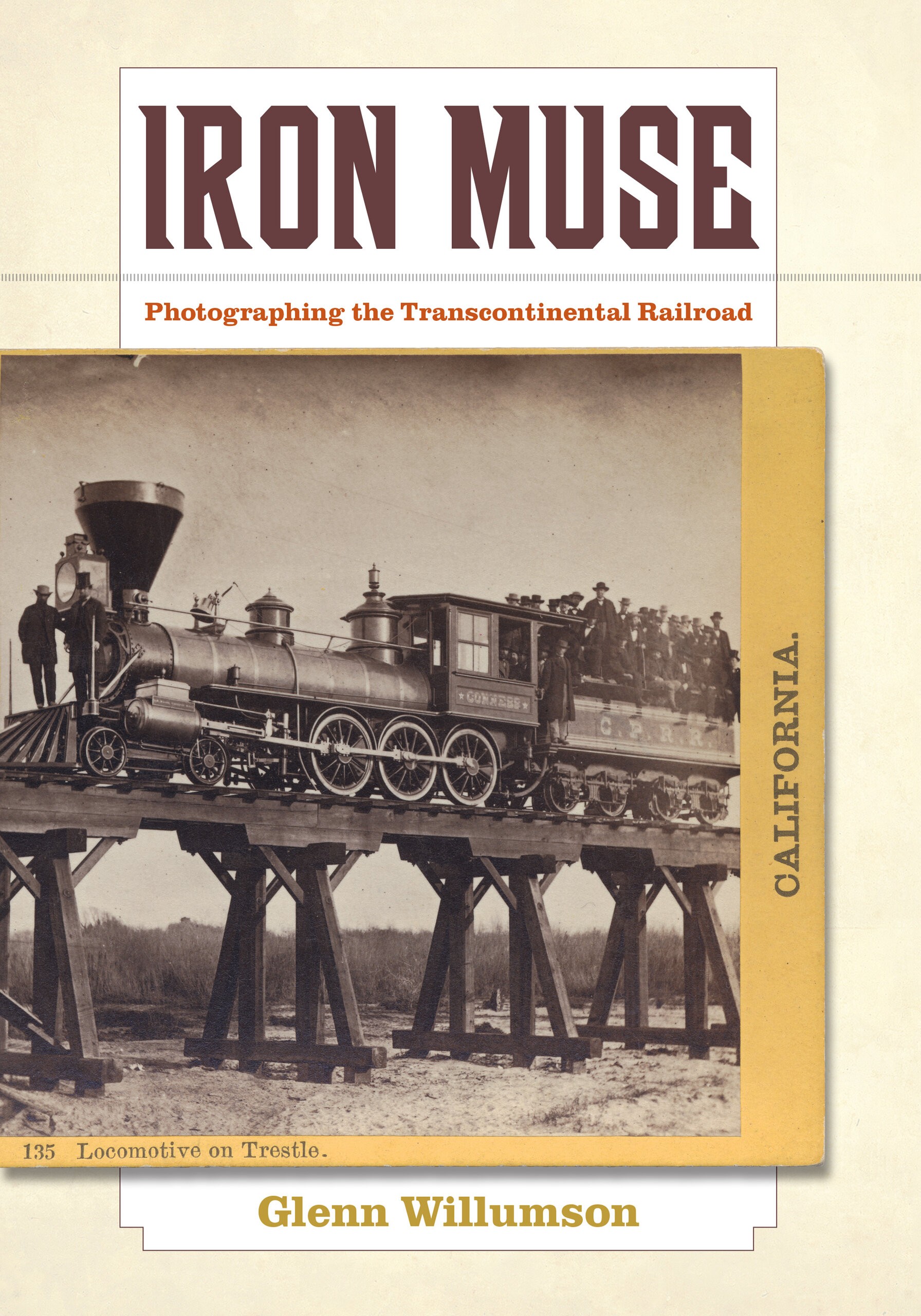
The construction of the transcontinental railroad (1865–1869) marked a milestone in United States history, symbolizing both the joining of the country’s two coasts and the taming of its frontier wilderness by modern technology. But it was through the power of images—and especially the photograph—that the railroad attained its iconic status. Iron Muse provides a unique look at the production, distribution, and publication of images of the transcontinental railroad: from their use as an official record by the railroad corporations, to their reproduction in the illustrated press and travel guides, and finally to their adaptation to direct sales and albums in the late nineteenth and twentieth centuries. Tracing the complex relationships and occasional conflicts between photographer, publisher, and curator as they crafted the photographs’ different meanings over time, Willumson provides a comprehensive portrayal of the creation and evolution of an important slice of American visual culture.


The construction of the transcontinental railroad (1865–1869) marked a milestone in United States history, symbolizing both the joining of the country’s two coasts and the taming of its frontier wilderness by modern technology. But it was through the powe
About the Author

Glenn Willumson is Director of the Graduate Program in Museum Studies and Professor of Art History at the University of Florida.

Table of Contents

Acknowledgments

Introduction

1. Preparing the Ground
2. Making the Photographs
3. Curating the Archive
4. Reproducing the Image

Epilogue

Notes
Selected Bibliography
List of Illustrations
Index

Reviews

"This meticulous investigation will appeal to historians of photography, of the American West, and of railroads. . . . Recommended."
CHOICE
"A detailed, well-researched analysis of the photography associated with the transcontinental railroad."
Western Historical Quarterly
"Glenn Willumson's book Iron Muse is a wonderfully written account of efforts to photograph the constuction of the transcontinental railroad and promote its successes... Wonderfully illustrated, this book relies on the larger visual culture of the era and reproduces prints, paintings, and newspapers as well as the photographs themselves...  Those without a stated interest in these topics will develop one because of the author's engaging writing style and compelling presentation."
Winterthur Portfolio
“One way to approach Glenn Willumson’s impressive book is to imagine yourself standing on the observation platform of a train speeding westward in 1868. Already disappearing from view are traditional ideas about the function of documentary photography, while at the other end of the train, precariously balanced on the cab of the locomotive, a photographer shoots pictures that show how successfully construction of the Transcontinental railroad is proceeding through the rugged western landscape. Willumson’s thoughtful, carefully researched narrative works between these two views of railroad photography, explaining how the passive was gradually being supplanted by the active, but not quite so openly or aggressively as to suggest that the railroad’s record of progress was any less authentic. Which tells us, once again, how effective such images were in selling the nineteenth-century West to the eastern half of the nation.”

-William Truettner, Senior Curator of Painting and Sculpture at the Smithsonian American Art Museum

“One comes away from this text with deeper appreciation of the production of these railroad images and of their manipulation, indeed with a heightened appreciation of the richness of the photographic archive itself."

-Kenneth Haltman, author of Looking Close and Seeing Far: Samuel Seymour, Titian Ramsay Peale, and the Art of the Long Expedition, 1818-1823